

Located in the southeastern corner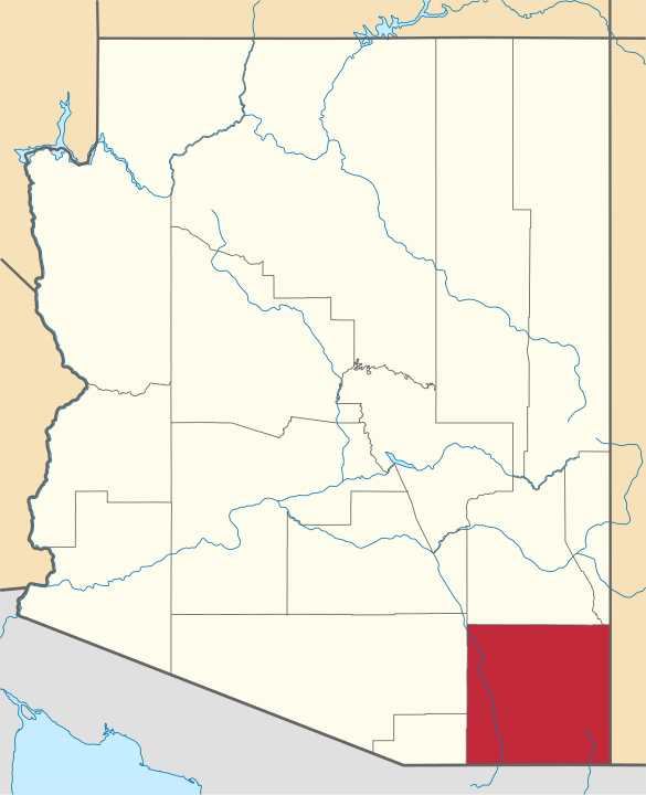 of Arizona, Cochise County shares approximately 84 miles of its border with Mexico. The U.S. Census estimates Cochise County’s population at about 131,346 residents with about 43,888 of the residents living in the city of Sierra Vista. The Cochise County Sheriff’s Department and the Sierra Vista Police Department are the most notable law enforcement agencies in the county.
Law enforcement agencies in the region deploy various surveillance technologies, including drones, body-worn cameras, and automated license plate readers. The federal government also keeps a close eye on the border region with technologies that include automated license plate readers, sensor towers, drones, and surveillance balloons.
Quick Links:
- Drones
- StarChase
- Body-Worn Cameras
- Automated License Plate Readers
- Camera-based Virtual Fence System
- Cell-site Simulators
- Face Recognition
- Military Police Camera Equipment
- Federal Technologies
Drones
Drones are remote-controlled vehicles that police use for aerial surveillance. Local agencies generally use compact, less expensive drones known as small unmanned aerial systems (sUAS) or quadrotors, as opposed to the larger systems deployed by the U.S. military and Department of Homeland Security.
Since 2018, the Sierra Vista Police Department has been developing an sUAS program, according to the Herald Review. But as of July 2019, it had not yet received approval from the Federal Aviation Administration (FAA). A police spokesperson told reporters that the drones will be used in search-and-rescue and SWAT operations.
The Cochise County Sheriff’s Office also has a drone that it uses in situations such as search and rescue, and jail security. The sheriff’s office will loan its drone to other departments in the county, such as the fire department.
The FAA issued the City of Tombstone a certificate to allow the city to expand its drone program, according to The Tombstone News. This certificate gives the Tombstone Marshal’s Office, Fire Department, and Public Works Departments the ability to fly a drone for various operations, including “search and rescue, firefighting, utility inspections, accident scene reconstruction, warrant service, and many other applications.”
Nearby Fort Huachuca is the largest unmanned aircraft systems training facility in the world, according to the Sierra Vista Economic Develop Department. It has 964 square miles of restricted air space. Defense agencies and contractors, including Northrop Grumman and Raytheon, test UAS systems at the base. U.S. Customs and Border Protection has operated General Atomics Predator B drones out of the Libby Army Airfield since 2011.
For more information:
- Sierra Vista Arizona: Unmanned Aircraft Systems
- Town of Huachuca: Budget Hearing Documents
- Herald Review: SVPD plans to start officer drone program
- The Tombstone News: FAA Approves Tombstone to Expand Drone Program
- Herald Review: Taking flight: Local authorities launch drone programs
StarChase
Police mount StarChase systems to the front of their patrol cars, and use them to fire a GPS tracking projectile that will stick to another vehicle. Described in product materials as a “pursuit management technology,” Starchase is marketed as a way to reduce the risk associated with car chases by allowing an officer to track a vehicle by GPS instead of following it at high-speed.
In 2009, the Arizona Department of Public Safety acquired Starchase systems through Operation Stonegarden, a program that funds local law enforcement to cooperate with federal agencies in border operations. According to public meeting records, in 2012 the state transferred two Starchase systems to the Cochise County Sheriff’s Office to support its participation in Operation Stonegarden.
For more information:
Body-Worn Cameras
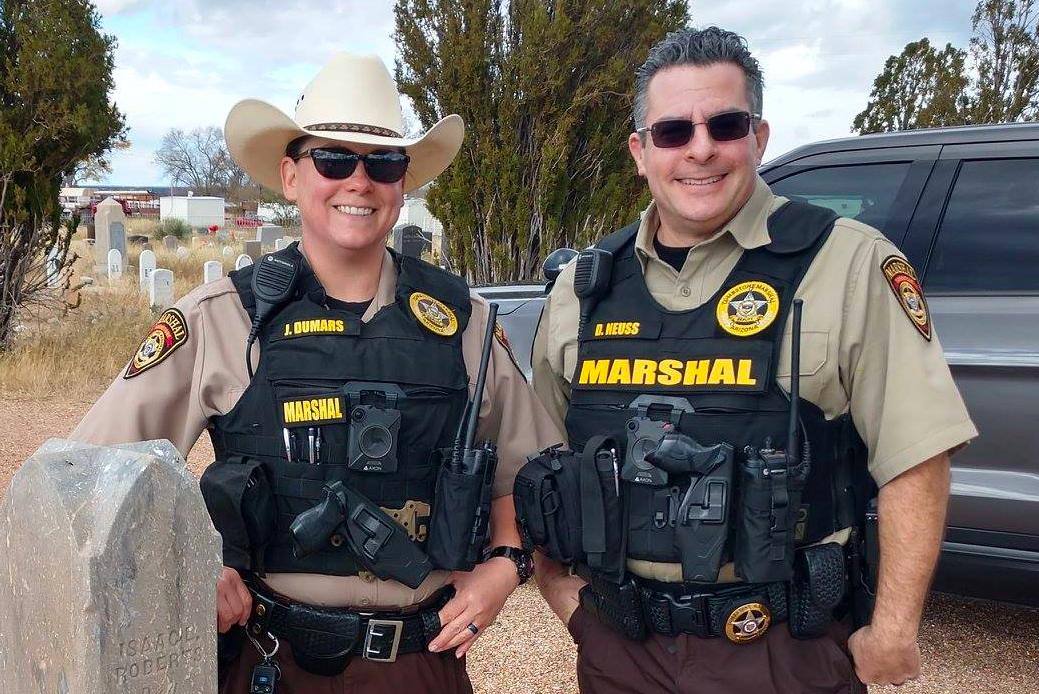
Tombstone Marshals wearing Axon body-worn cameras. Source: TMO Facebook
Body-worn cameras (BWCs) are small devices attached to an officer’s uniform that capture video and audio of the officer’s encounters with the public. Often billed as a measure to enhance police accountability, BWCs can also function as a mobile surveillance network.
In March 2019, Cochise County approved a five-year agreement with Axon to provide the Sheriff’s Office with 60 body-worn cameras for patrol deputies. The purchase also included 119 Tasers equipped with “smart batteries” that wirelessly trigger all BWCs within 10 to 15 feet anytime a Taser is activated.
In early 2017, the Sierra Vista Police Department signed a five-year contract for 62 body-worn cameras from Axon, according to the Herald Review. The cameras are manually activated. A police spokesperson told reporters that officers are supposed to turn them on “for most routine activities, like traffic stops, arrests and other instances of citizen interactions.”
The Huachuca City Police Department also has Axon BWCs, according to its 2017-2018 budget. In addition, the Tombstone Marshal’s Office has Axon BWCs, as indicated through several pictures on their Facebook page.
For more information:
- Herald/Review: Sierra Vista police ready to don body cameras next week
- Cochise County Sheriff: Board of Supervisors Meeting 03/26/2019
- Town of Huachuca City: 2017 Budget
Learn more about body-worn cameras.
Automatic License Plate Readers
Automated license plate readers (ALPRs) are networks of cameras used to track the movements of vehicles. Police attach cameras to patrol cars or fixed locations, like highway overpasses, to amass a searchable database that can reveal a driver’s movements. Police also add license plates to a “hot list” to get real-time alerts whenever the vehicle is photographed by an ALPR.
The Cochise County Sheriff’s Office will purchase eight ALPRs this year with $300,000 in grant money through Operation Stonegarden, which as noted earlier, is a program that funds local law enforcement to assist in border security. According to the Sheriff’s Office, the ALPRs will be placed along “prime roadways” to “uncover vehicles and/or ‘persons of interest’ transporting narcotics, undocumented aliens, weapons or illegal proceeds from Mexico into the United States or vice versa.”
The Benson Police Department also has an ALPR thanks to an Operation Stonegarden Grant from 2009. This ALPR is used to find stolen vehicles, and to get information on “vehicles of interest for a specific reason.”
Federal agencies actively use ALPRs in the region, including the U.S. Drug Enforcement Administration and U.S. Customs and Border Protection.
For more information:
- Cochise County Board of Supervisors: 04/23/2019 Agenda
- Herald/Review: CCSO to receive $1.487 million Operation Stone Garden grant
- City of Benson: 2009 City Council Meeting
Learn more about automated license plate readers.
Camera-based Virtual Fence System
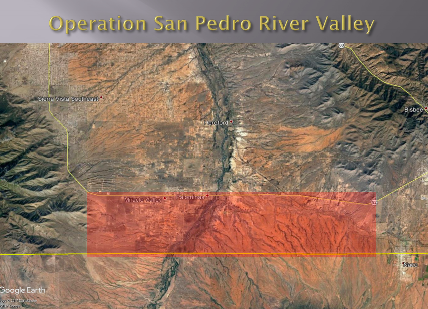
The red shading indicates location of BuckEye Cameras. Source: Joint Border Security Advisory Committee Presentation - 2017 Review
In 2016, the Cochise County Sheriff’s Office began building a “virtual fence system” from 50 wireless cameras. It is funded by the Joint Border Security Advisory Committee, a state body overseeing border issues. According to a request to increase funding, the Sheriff’s office placed these BuckEye cameras in a 42-square mile area in the San Pedro River Valley that covers about 14 miles of the U.S.-Mexico border and extends three miles north from the border. In 2017, the cameras were used in 37 felony drug arrests and the interception of 4,000 pounds of cannabis.
In the first year, however, the sheriff reported that 90% of the images taken with BuckEye cameras produce false alerts due to the movement of animals and vegetation. To address this, Cochise County contracted with Cogniac, a firm that The Intercept identified as receiving investment from Google, to provide “computer vision” automated image processing on the footage.
For more information:
Cell-Site Simulators
Cell-site simulators, also known as Stingrays or IMSI catchers, are devices that masquerade as cell-phone towers, tricking phones within a certain radius into connecting to the device rather than a tower.
While the Cochise County Sheriff’s Office does not own a cell-site simulator, search warrant records obtained by a local reporter show that deputies have the ability to access such a device maintained by the U.S. Marshals Service.
For more information:
- The County of Cochise: Support for Tracking Device Warrant
- The County of Cochise: Cell-Site Simulator Search Warrant
Learn more about cell-site simulators.
Face Recognition
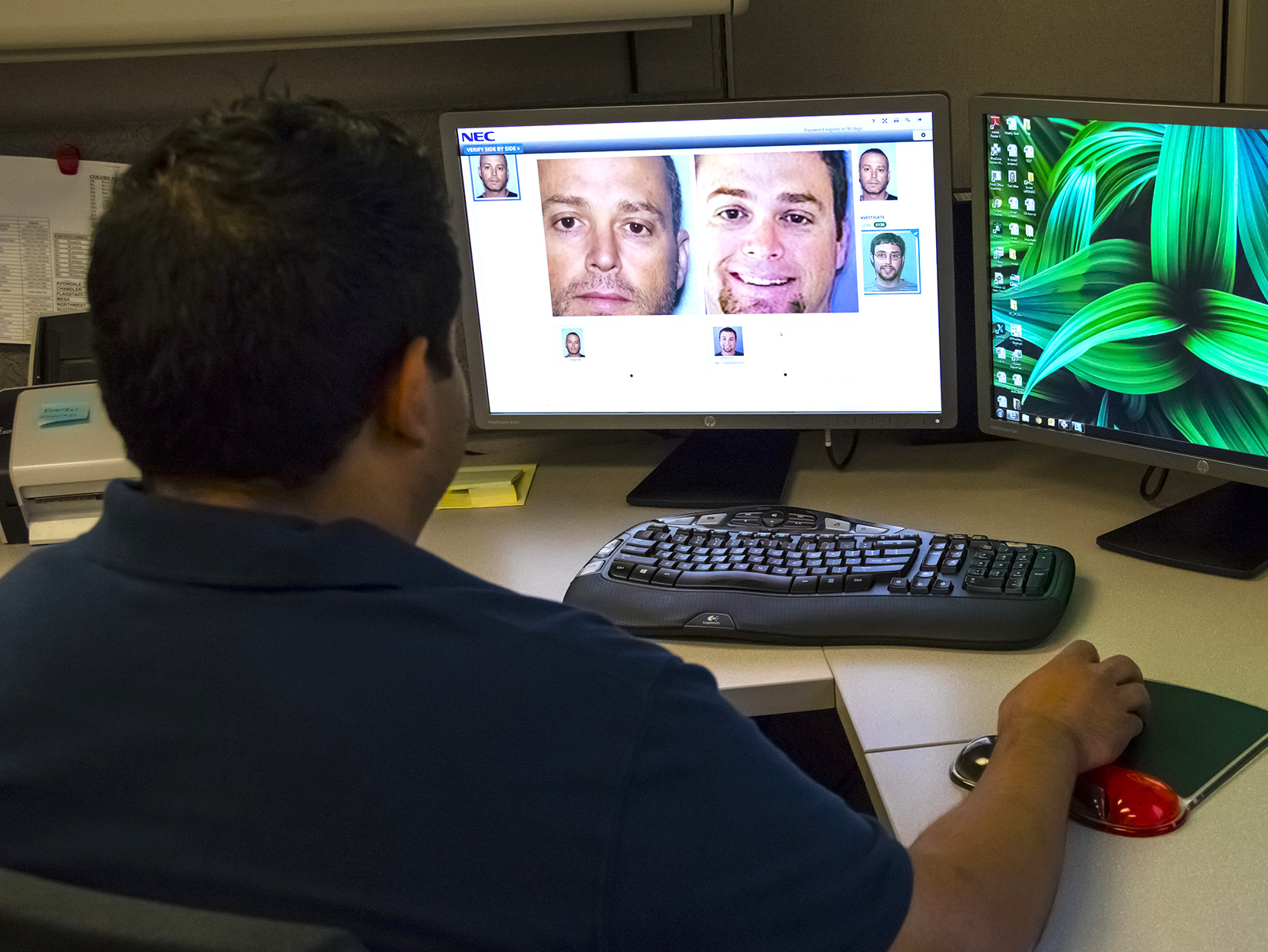
Arizona Department of Transportation official demonstrates face recognition. Source: ADOT.
The Arizona Department of Transportation (ADOT) uses face recognition technology on the state’s driver’s license database, primarily as a fraud prevention measure. Local and federal agencies do not have direct access to this system, but may ask ADOT to conduct searches on its behalf. Meanwhile, the Arizona Department of Public Safety has a "Facial Recognition Unit" with access to a database of 15-million mugshots. The unit assists both local and federal investigators in identifying subjects.
For more Information:
- Capitol Media Services: ADOT use of facial recognition strictly limited, official says
- KGUN: Use of database of driver’s license photos raises questions
- Arizona Department of Transportation: Step by step, ADOT facial recognition process guards against identity fraud
Learn more about face recognition.
Military Police Camera Equipment
In late 2013, the Fort Huachuca Military Police Department purchased 22 Panasonic Arbitrator digital video systems to capture 360-degree footage of everything inside and outside of patrol vehicles. The purchase also included Toughbook tablets that police can use to capture images of crime scenes and scan license plates.
For more information:
- Panasonic: Fort Huachuca
- Panasonic: Fort Huachuca Police Advance Mobile Efficiency with Panasonic Solution
Federal Technologies
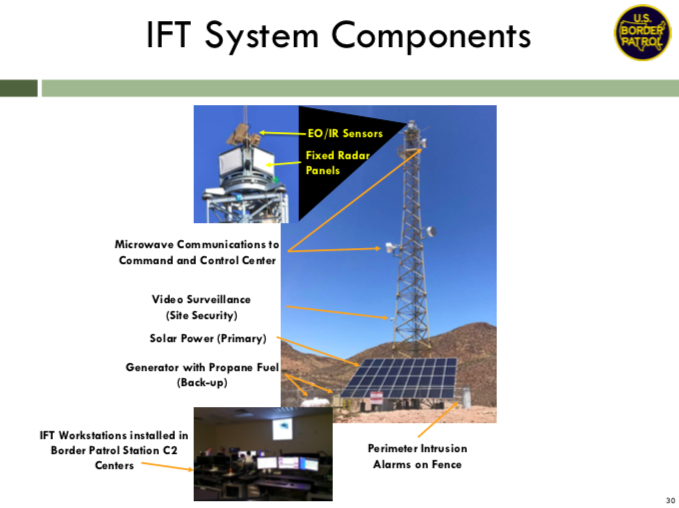
The components of an integrated fixed tower. Source: Border Patrol industry day presentation
Cochise County is located in U.S. Customs and Border Protection’s Tucson Sector. The CBP has Integrated Fixed Tower (IFT) systems and Remote Video Surveillance Systems (RVSS) in the sector. IFT systems automatically detect and track items of interest and provide operators with data, video, and geospatial location of selected items of interest to identify and classify them. RVSS technology provides long- to short-range surveillance with cameras, radio, and microwave transmitters. They send video to a control room for an operator to remotely detect, track, identify, and classify targets in the video feed.

CBP aerostat based at Fort Huachuca, Arizona. Source: CBP Flickr
CBP also has an “aerostat” stationed at Fort Huachuca that can be used for surveillance in Cochise County. This aerostat is an unmanned blimp that has a radar that can detect all flying aircraft within 200 miles. According to data published by the U.S. Government Accountability Office, between 2014 and 2016, these aerostats assisted in 70 apprehensions and the seizure of 1,594 pounds of cannabis in the Tucson Sector. However, only one of these apprehensions was reported by the Border Patrol station in Bisbee County.
For more information: